
GIS Application Development
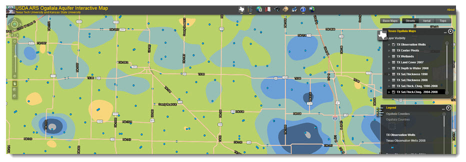
Online maps are frequently used to discover locations and features about that location. With the advent of smart devices and Google Maps, people have access to maps and information in the palm of their hands. Web GIS is still a relatively new tool. Although most mainstream web GIS products such as Google Earth, Bing Maps and Openstreet Map provide a wealth of location information to their audience, they are limited in providing analytical results. Custom web-based GIS applications help resolve this limitation. Web GIS integrates data from various sources, as well as custom data and GIS analytics to produce visually interpretive maps and charts. For the non- GIS professional, GIS web-mapping offers an easy-to-use yet powerful tool for making informed decisions.
There are several nuances for developing interactive maps on the web, but the three most common means are Silverlight, Flex and Javascript. CGST is developing interactive mapping solutions for local, state and federal agencies using mainly Flex and Javascript APIs from Esri®, Leaflet and Openlayers.
CGST has developed several applications, some of which are showcased below


