|
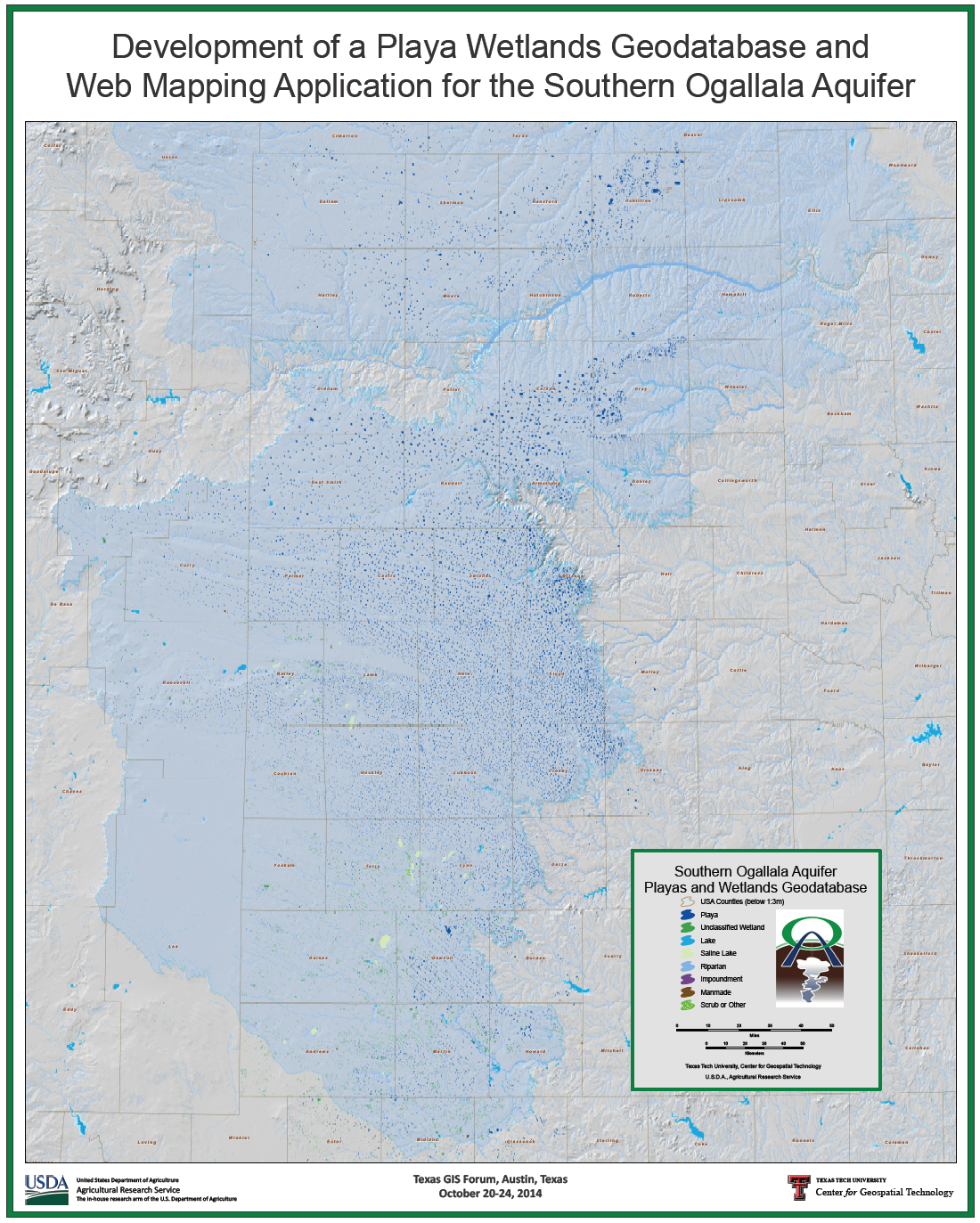
Playa Wetlands Geodatabase and Web Mapping Application
by Lucia Barbato and Kevin Mulligan
Map won
First Place in the
Map Competition sponsored by the
Texas Natural Resources Information System (TNRIS) in Austin, TX.
|
|
Projected Usable Lifetime of the Ogallala Aquifer
by Lucia Barbato, Kevin Mulligan, and Santosh Seshadri
Map won
Third Place in the
Best Use of ESRI Basemap in the map gallery competition.
|
|
Analysis of U.S. Drought Contitions 2000-2012
by Iana Rufino, Lucia Barbato, Kevin Mulligan, and Santosh Seshadri
Map won
First Place in the
Map Competition sponsored by the
Texas Natural Resources Information System (TNRIS) in Austin, TX.
|
|
Mapping the Southern Ogallala Aquifer in Texas, Saturated Thickness Change 1990 - 2004
by Lucia Barbato, Kevin Mulligan, Ken Rainwater and Ada Warren
Map won
First Place in the
Map Competition sponsored by the
Texas Natural Resources Information System (TNRIS) in Austin, TX.
|
|
Brian's World - The Way to my DQ
by Brian Mulligan
Map won
Third Place in the
Best Student Presentation K-12 in the map gallery competition.
|
|
Special Achievement in GIS
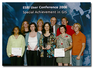
|

The GISCorps
is a program of the Urban and Regional Information Systems
Association. The organization is composed of GIS professionals
who volunteer their services for short term projects involving
support for humanitarian relief, community development, local
capacity building, health and education. |
|
Lucia Barbato (front row fourth from left) receives a Special Achievement in GIS
award for her volunteer
work with the GISCorps during Hurricane Katrina. Others in the
photograph include Shoreh Elhami (front row center) co-founder of
the GISCorps and Jack Dangermond (second row third from left)
president of ESRI.
|
|
A Unified Model of Phylogeography
by Hugo Mantilla-Meluk, Robert Baker and Kevin Mulligan
The poster won Second Place for Best Analytical
Presentation in the Map Gallery competition.
|
|
Digital Atlas of New Mexico Counties
by Kevin Mulligan, Lucia Barbato, Rob DeBaca, James B. Speer, and Kiran Masapari
The atlas won
Second Place for
Best Cartographic Design – Map Series or
Atlas-In-House in the Map Gallery competition.
|
|
The Llano Estacado
by Kevin R. Mulligan
Map won
First Place in the
Map Competition sponsored by the
Texas Natural Resources Information System (TNRIS) in Austin, TX.
|
|
High Resolution Mapping with Ground-Based LIDAR, White Sands, New Mexico
by Kevin Mulligan, Seiichi Nagihara, and Wei Xiong.
The poster won
First Place for
Most Unique in the Map Gallery
competition. |
|
|

 Twenty-Fourth Annual Texas GIS Forum (2014)
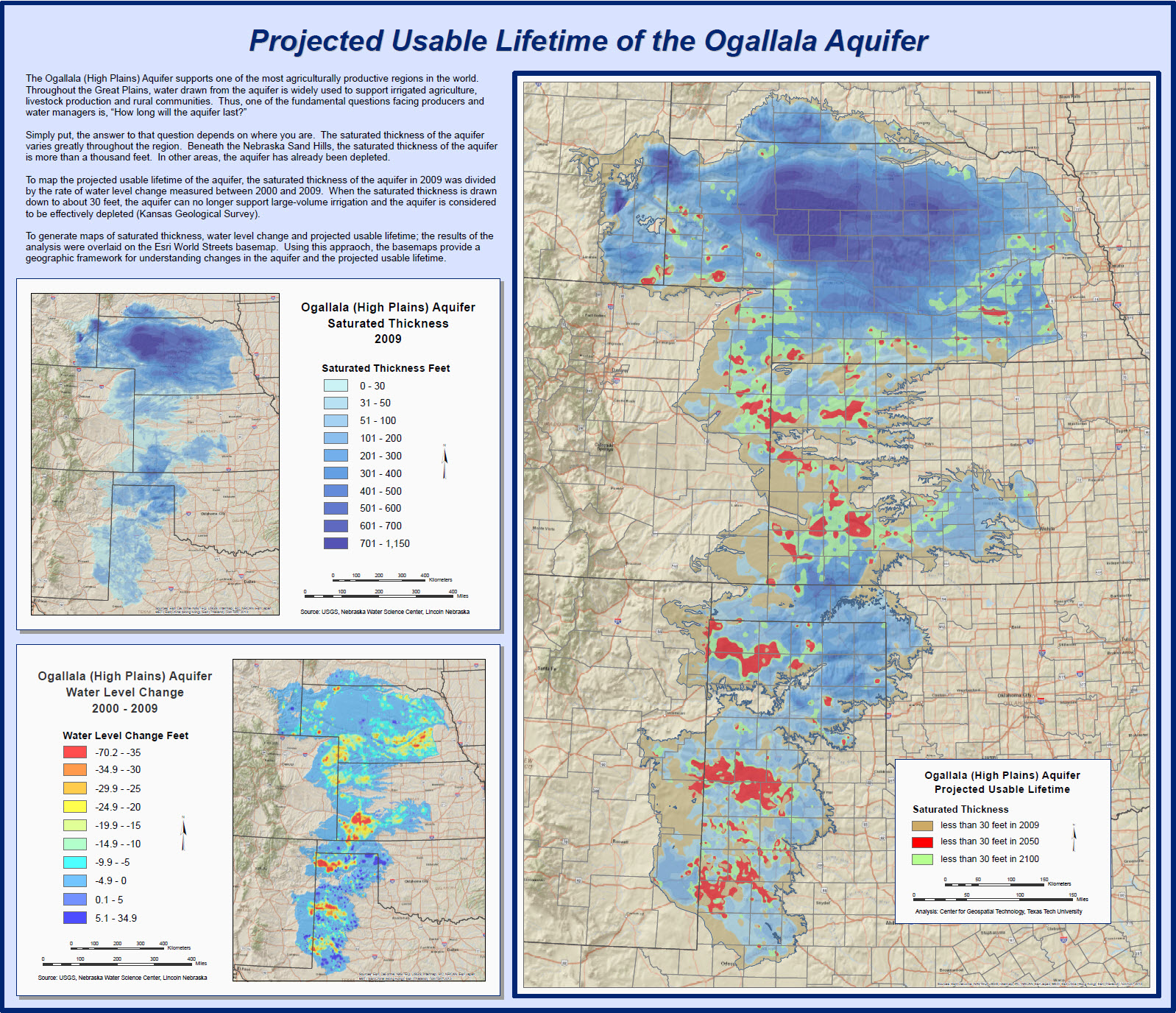 Thirty-Third Annual ESRI International User Conference (2013)
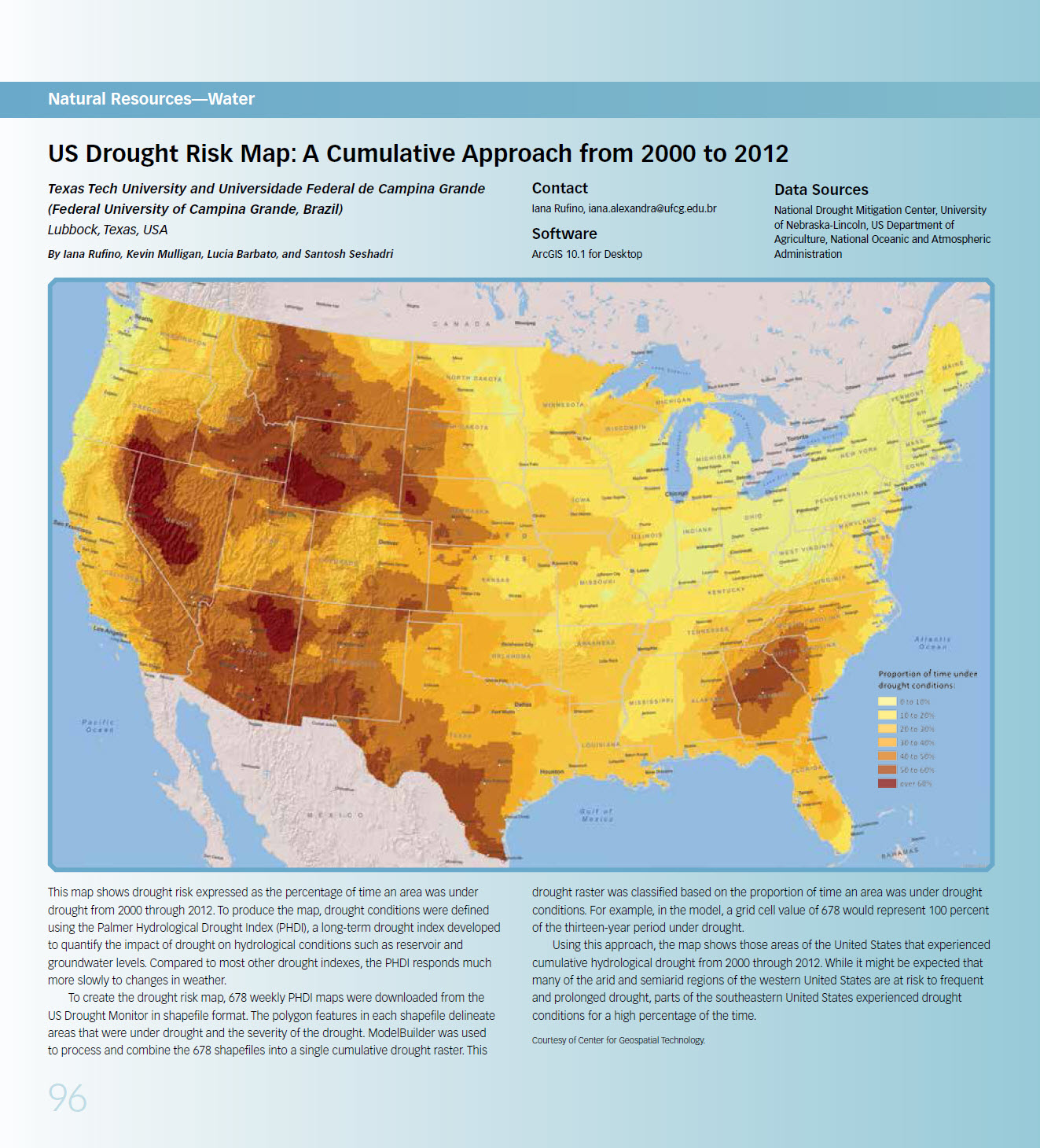 Twenty-Third Annual Texas GIS Forum (2013)
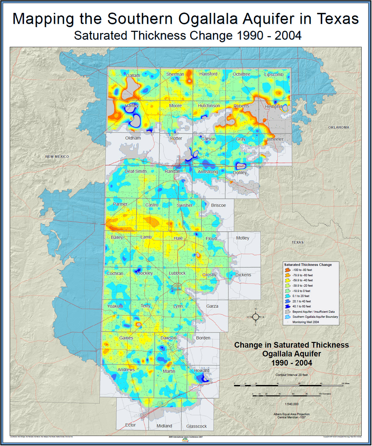 Seventeenth Annual Texas GIS Forum (2007)
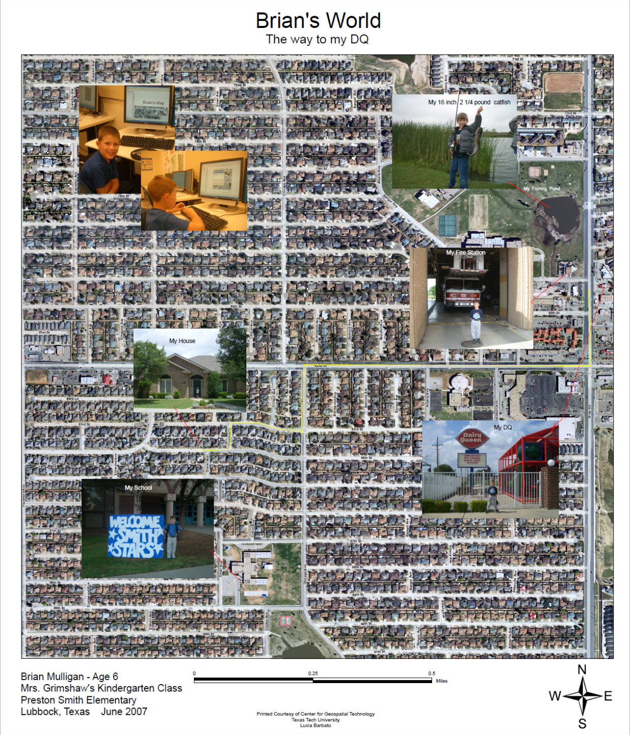 Twenty-Seventh Annual ESRI International User Conference (2007)
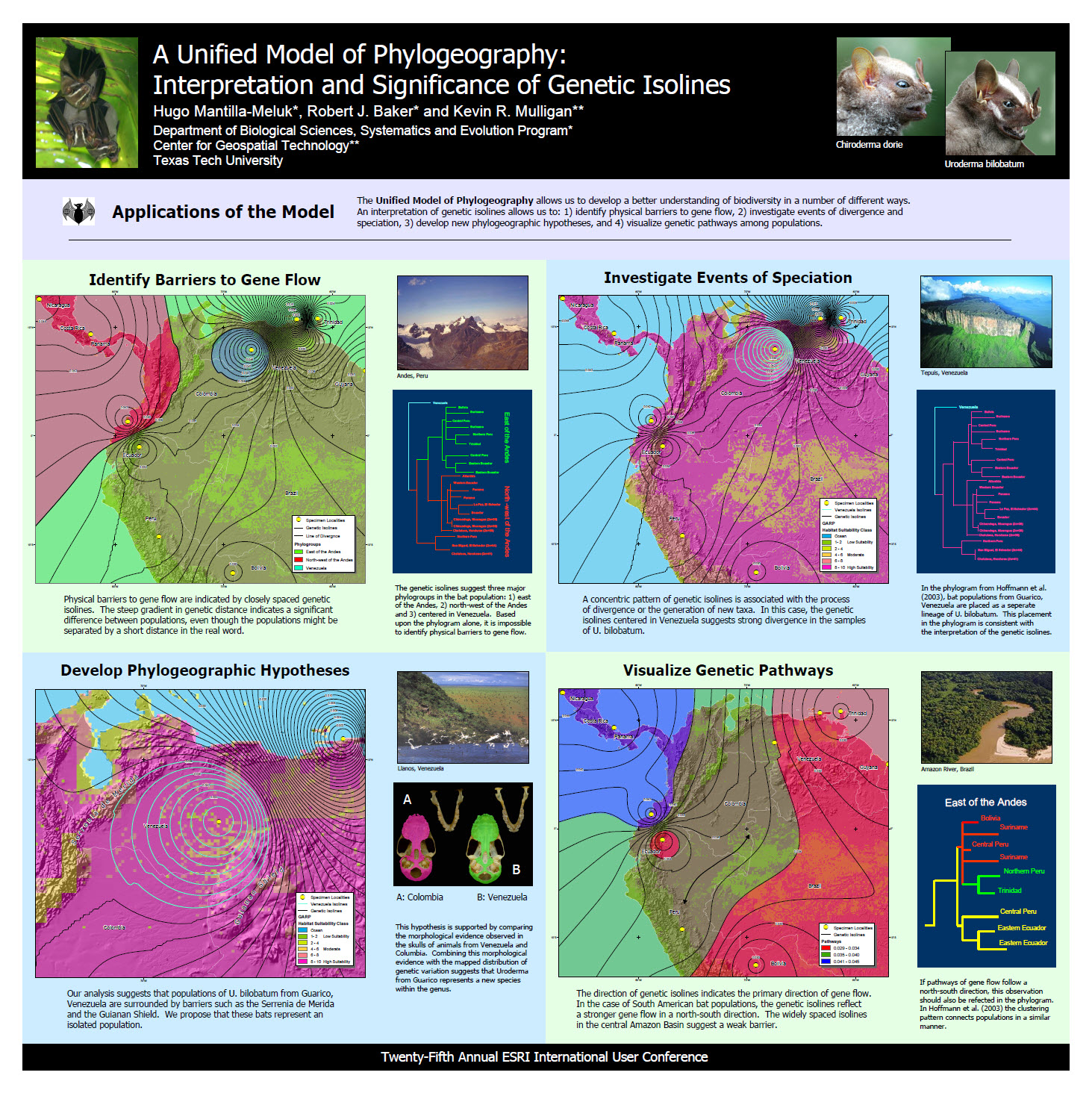 Twenty-Fifth Annual ESRI International User Conference (2005)
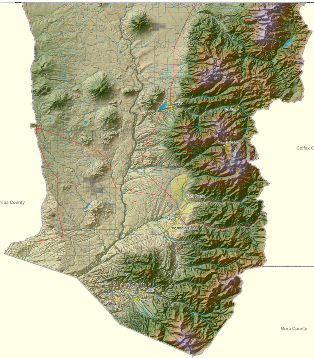 Twenty-Fourth Annual ESRI International User Conference (2004)
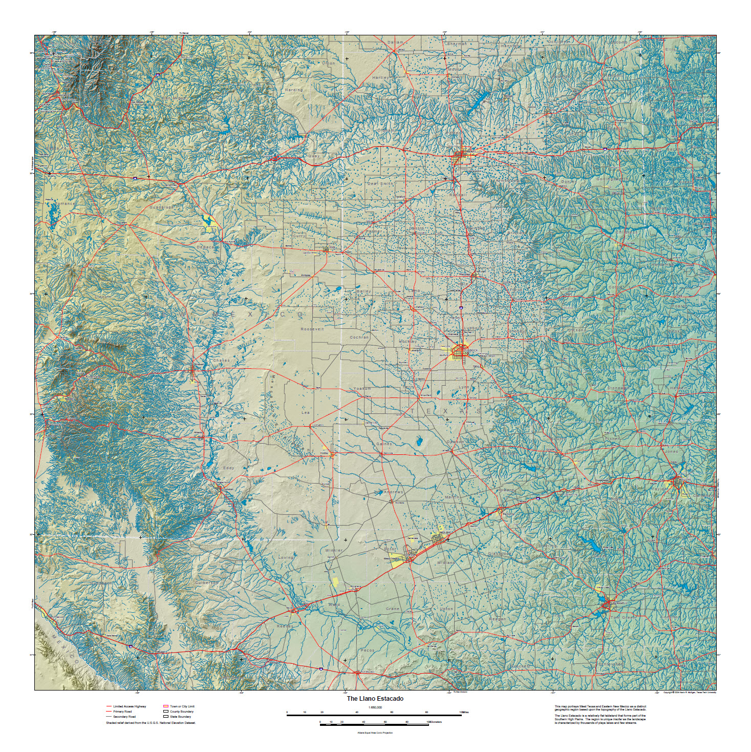 Fourteenth Annual Texas GIS Forum (2004)
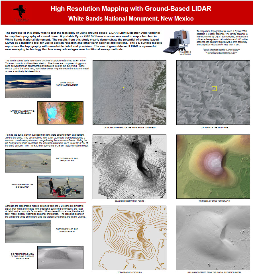 Twenty-Third Annual ESRI International User Conference (2003)