
Current Research
3D Modeling of Historical Archaeology and Landscapes with an Unmanned Aerial Vehicle (UAV) Drone
Advances in 3D modeling techniques are rapidly changing the fields of Cultural Heritage and Archaeology. Multi-image photogrammetry is a process of capturing three-dimensional points from overlapping images taken by a camera and is based on trigonometry. This technique for digitizing cultural heritage is increasingly being adopted due to its versatility, low cost, and high accuracy.
Photogrammetry often takes place on the ground, and is suitable for small areas of interest and objects that researchers can encompass successfully with overlapping photographs. For larger historical objects, such as historic buildings, and for larger areas of interest, such as fence lines and examining historical objects within a greater landscape context, aerial images are needed. Unmanned aerial vehicles (UAV), commonly referred to as drones, are a light aerial platform that can take images from the sky with a consumer grade digital camera.
This past year, the Landmark research team received funding from the Texas Tech Scholarship Catalyst Program to acquire a UAV. The UAV was used during the 2016 field season to document several historic structures in the Post research area.
Maxey Homestead
Brothers S.F. Maxey and J.F. Maxey acquired two sections of land from the State of Texas to develop into a homestead in 1902. J.F Maxey and family remained on the property to subsistence farm until they sold their property to John B. Slaughter in 1914. J.F. Maxey and his family then moved their wood framed house to a new location ~9km (5.5 miles) to the north near Spring Creek. The construction of the wood-framed house was notable by the inclusion of local Ogallala Formation gravels embedded on the exterior walls. The UAV was used this past summer to document the historic structures and surrounding landscape at the 1914 F. Maxey homestead.
Press play on the model to explore the Maxey Homestead in 3D. You can drag and rotate the image to see it at all angles.
Skip 3D modelJumbo Ranch
The Jumbo Cattle Company formed in 1883 and established their range in present day Garza, Borden, Scurry, and Kent counties. They did not own all of their range, and the void of leases through litigation along with the release of lands to settlers strained the company. By 1900, the Jumbo Ranch was bankrupt. The Landmark research team found the original headquarters location of the Jumbo Ranch, and it provides important insights into early cattle ranching life in the 1880s.
Press play on the model to explore the Jumbo Ranch in 3D. You can drag and rotate the image to see it at all angles.
Skip 3D modelPastores Corral
The Landmark research team found a possible pastores sheep corral located in a sheltered spot along the escarpment edge. The corral is ~98ft in diameter and was constructed by stacking unmodified caliche rock ~3ft high off the ground. The pastores were Hispanic sheep herders from New Mexico that made their way onto the Llano Estacado in the 1870s to use the plentiful grasslands. The pastores were the first Euro-American settlers in the region.
Press play on the model to explore a Pastores Corral in 3D. You can drag and rotate the image to see it at all angles.
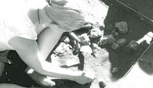
Skip 3D model4JK Locality 5 Buffalo Hunter's Dugout
Excavation has been on-going at a buffalo hunter's dugout found by the Landmark research team in 2009. Based on cultural objects and the historical record the dugout likely was occupied sometime between ~1877-1879. The dugout was constructed as a more permanent campsite for the buffalo hunters to occupy while hunting bison within the region. Buffalo hunters flooded the region from 1874-1879 after the removal of the Comanche. These hunters remained active in the region until 1879 when the bison was hunted to near extinction.