2024 Field Research Program
Field Season 2024 Volunteer Schedule
- First Session: June 2nd - July 14th
- Post research area
Sunday, 2 June: Volunteers Arrive
Monday, 3 June: Volunteer Orientation
Sunday, 14 July: Volunteers Depart - Second Session: July 8th - August 18th
- Post research areas or Lubbock Lake Landmark
Sunday, 8 July: Volunteers Arrive
Monday, 9 July: Volunteer Orientation
Sunday, 18 August: Volunteers Depart
Apply early to ensure a placement.
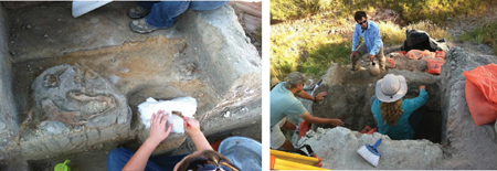
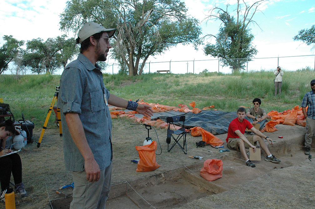
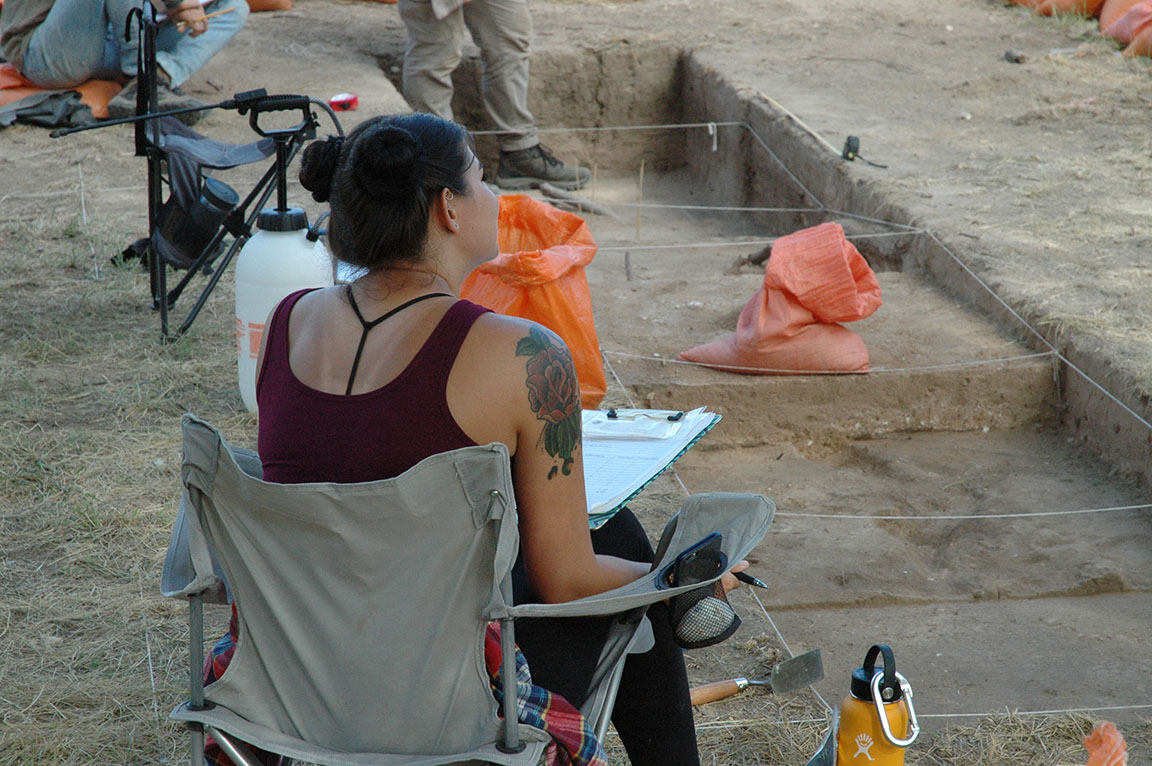
Work with the professional staff of the Lubbock Lake Landmark Regional Research Program. Join an ongoing field research program of international volunteer crews and conduct surveys, geoarchaeological prospecting, mapping, and excavations at the Post research areas and at the Lubbock Lake Landmark.
Although not a field school, volunteers for the Lubbock Lake Landmark regional research program gain practical experience in field methodologies using the latest in field recording technology, proper field conservation of materials, and laboratory experience in processing materials from the field.
Interested? Read the Landmark Volunteer Information Guide here.
Then, fill out a Volunteer Application Form here.
Upon review of the application form and two letters of recommendation, volunteers are provisionally accepted into the Landmark's regional research program. Following provisional acceptance, volunteers must email the Landmark's medical history form filled out by a licensed physician, proof of current tetanus vaccination, proof of covid-19 vaccination, and proof of adequate and appropriate health insurance during their stay at Lubbock Lake Landmark to Dr. Johnson at eileen.johnson@ttu.edu .
Community and Youth Volunteers
Lubbock Lake Landmark also welcomes youth and community volunteers to participate in its Summer Field Season. The requirements and applications for these volunteers vary. Additional information for community and youth volunteers.
Site Information
Lubbock Lake Landmark - July 8th-August 18th
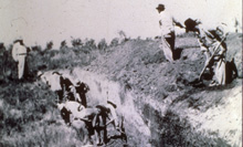
Lubbock Lake is located on the Southern High Plains in a meander of an ancient valley (Yellowhouse Draw) near ancient springs. People used the water resources in the draw for thousands of years until those resources went dry in the early 1930s. In 1936, the city of Lubbock dredged the meander in an effort to revitalize the underground springs. That activity revealed the long-occupied site.
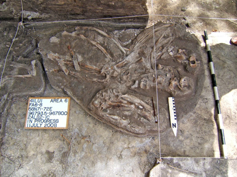
The first explorations of the site were conducted in 1939 by the West Texas Museum (now the Museum of Texas Tech University). By the late 1940s, several Folsom Period (10,800-10,300 years ago) bison kills were discovered. Charred bison bones from an ancient bison kill from a then unidentified Paleoindian group produced the first ever radiocarbon date (currently the most accurate form of dating) for Paleoindian material (9,800 years old). The Landmark currently serves as a field laboratory for geology, soils, and radiocarbon dating studies, as well as being an active archaeological and natural history preserve.
Physiographic Setting
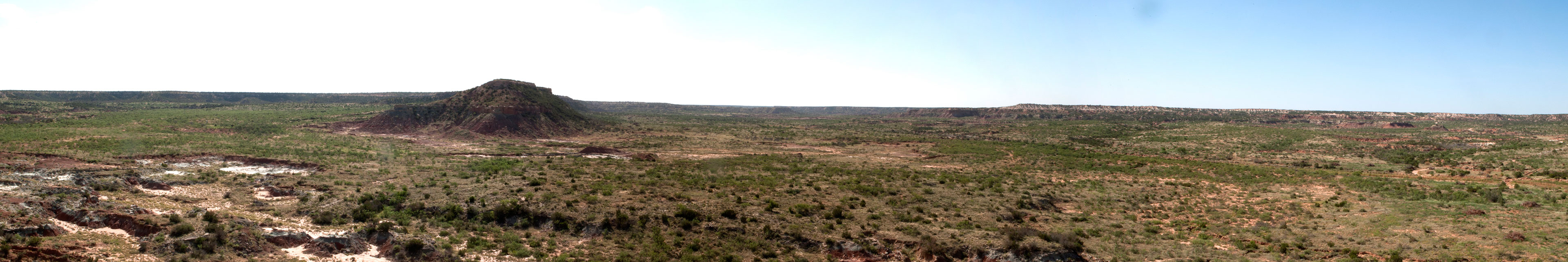
The Lubbock Lake Landmark is located on the southeastern portion of the Southern High Plains (Llano Estacado) of western Texas. The ca. 300 acre (121 hectare) site encompasses both upland and lowland settings. The Southern High Plains today has a continental climate. The region experiences a large temperature range. Rainfall occurs throughout the year, but highs are in the spring and fall. Summer droughts are common due to high pressure that dominates the region during this time.
2024 Fieldwork
For the 2024 Field Season, the Landmark research team will renew investigations of Protohistoric-age (1450-1650) Apache hunter-gatherers. Excavation will focus on exposing more of the Protohistoric living surface and features preserved at Area 8.
The Landmark is developing research to examine the territorial identity of these hunter-gatherers. Information learned from this field work will help to address the following research questions: 1. What is the relationship between material culture, identity, and territories? 2. Did the Apache develop a territorial identity on the landscape that distinguished themselves from other hunter-gatherer groups?
A territory is defined as a landscape spatial unit controlled by a society that share a social identity and tie to the landscape and distinguish themselves from other societies in adjacent territories. From this perspective, identity is equivalent to a territory. Territories are defined and infused with multiple layers of socially constructed meaning through daily interactions with the landscape.
The Protohistoric on the Southern High Plains is a culturally dynamic period marked by the migration of the Apache into the region, and the development of an intensive Southwest Puebloan trade network. Pedro de Castañeda, the chronicler of the Coronado expedition (1540-1542 AD), documented two culturally distinct nomadic bison hunting groups. This research will explore the formation of Apache territorial identity in relationship to other hunter-gatherer groups in the region.
Post - Session 1: June 2nd-July 14th,
Session 2: July 8th-August 18th
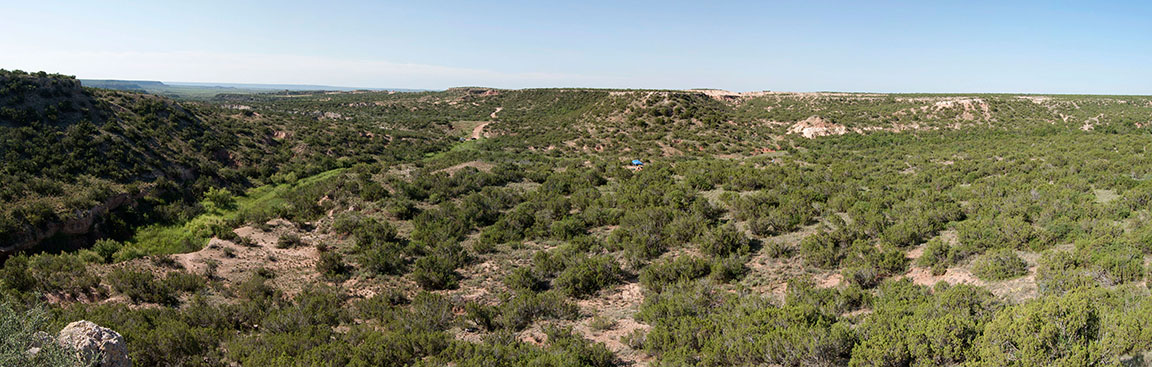
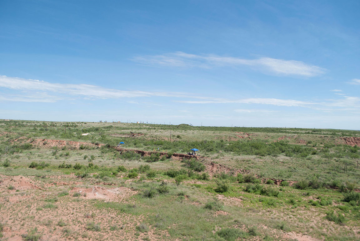
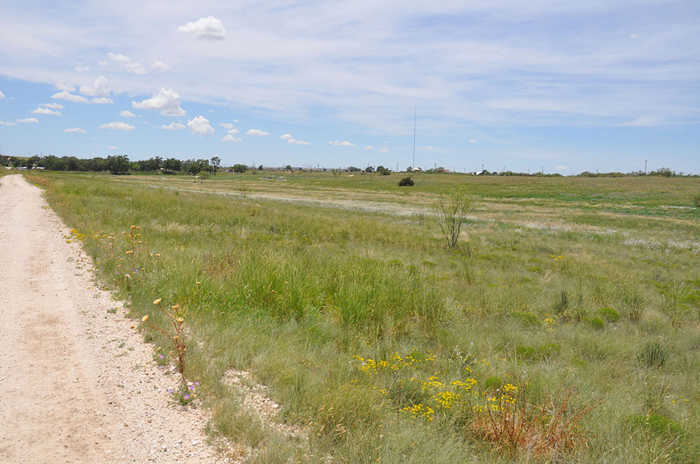
The Post research area is a ca. 83,000 acre ranch near Post, Texas. This ranch is part of a vast turn of the century ranchland that has remained within the same family, having been used continuously for cattle ranching since the 1880s. The landscape generally is pristine and sites undisturbed due to the highly limited access to and minimal development of the ranchland. This situation has resulted in a unprecedented preserved surface expression of the cultural landscape. The research value indicated at targeted sites suggests that they hold significant potential to inform regional models of aboriginal behavior and decision-making during thousands of years of occupation. Understanding the relationship of the material remains recovered from these sites within a wider landscape perspective represents one of the primary research objectives of the ongoing program of investigations.
Current research began in 2005 and the fieldwork for the 2023 season takes place in several localities. Lab work is carried out in the on-site camp facilities as well as at the Lubbock Lake National Historic Landmark.
An article based on our work at the Post Research area was published in Archaeology Magazine.
Physiographic Setting
Garza County is located in western Texas with part of the county on the eastern Llano Estacado and the other part below the Caprock on the Rolling Plains. The landscape below the Caprock consists of rough broken land that is drained by numerous tributaries of the Brazos River system. The South Fork of the Double Mountain Fork of the Brazos River runs through the property trending from the northwest to the southeast. The targeted sites are located just above and below the escarpment.