 |
|||||||||||
 |
|||||||||||
 |
|||||||||||
|
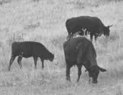
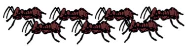
Imagine standing in a red fire ant bed for 10 minutes to get a free ice cream cone. Most likely you will be stung several times and it will be a pretty good incentive not to be there. Well, that is the best way Dr. Andy Herring, associate professor of animal science and food technology at Texas Tech University, can describe why they are studying the effects red imported fire ants (RIFA) have on livestock. "We are trying to find
out if the concentrations of fire ants really affect how the cow acts
in the pasture, how they spend their time and if they stay away from areas
that are really dense in fire ants," Herring said. To determine the affects RIFA have on beef cattle, there must be an estimate on the number of RIFA in the pasture where cattle are grazing. To make this estimate, there is a grid set up in the pasture containing 24 cells. The cells are established utilizing Geographic Information System (GIS) software in conjunction with a map of the pasture with a hand-held Global Positioning System (GPS) unit. "By doing this we know
where each of the cells in the pasture are located, and then we can measure
the RIFA mound density and activity in each cell to get an estimate of
the number of RIFA in each cell and the pasture as a whole," Galen
Austin, a graduate student in animal science and food technology at TTU,
said. "We must also know when
the cattle are grazing and when they are not," Austin said. To find this information, a
vibracorder is used, which is an instrument that contains a clock and
a chart that is placed around the neck of the grazing animal. The chart
is synchronized with the clock so as long as the animal has its head down
grazing, the chart will be marked and will indicate the day, time of day
and how long the animal is grazing. To find where the animal is
located, a GPS unit, similar to the hand-held GPS unit used to map the
pasture, was developed to attach to the cattle. The cattle GPS units were
developed with assistance from Gerry Creagor in the network engineering
depart- ment at Texas A&M University. The GPS units provide a positional
location of the animal on the earth in latitude and longitude by utilizing
radio signals With the cattle tracking GPS system, the data points (in latitude and longitude as well as time of day) that are collected by each GPS unit in an animal are corrected for inherent errors and then relayed by radio signal to a remote base station that automatically downloads the data to a computer. "By doing this we have
the data points the instant they are collected, and we do not have to
do any post-processing of the data to eliminate the inherent errors,"
Austin said. Once all of the different sources
of data are collected, they are combined to determine when the cattle
were grazing, at what location and what the estimated number of fire ants
were in the grazing location. "By combining all of the
data, we can deduce if fire ants have an affect in the grazing behavior
of cattle," Austin said. A survey that was conducted
in the early 1990’s showed that the Texas cattle industry loses over
$60 million each year due to fire ant problems. "We know that there are differences in fire ant location, but whether or not they actually effect livestock, we don’t know," Herring said. "That’s why we are conducting this research." |
|||||||||||