
GIS Enterprise Solutions

An Enterprise GIS is a geographic information system that is integrated through an entire organization so that a large number of users can manage, share, and use spatial data and related information to address a variety of needs, including data creation, modification, visualization, analysis, and dissemination. In addition to providing users with GIS capabilities, Enterprise GIS is also made available to other software systems, including those dedicated to Spatial function or those that can usefully benefit from the inclusion of spatial information or processing.
 CPRIT Projects Mapper
The CPRIT Projects Mapper is an open source GIS application hosted on the Amazon cloud that dynamically updates a map of Texas counties as different sets of variables are selected. The application integrates Leaflet, High Charts and MySQL software applications with PHP, GeoJSON and JavaScript programming languages to bridge the communication between application programs.
 North Plains GCD Water Manager
North Plains GCD Water Manager is an enterprise solution combining Esri, Geoserver and Openlayers. The desktop application will manage data entry for well permitting, registration, and production reporting. The web application will also integrate with the existing Geographic Information System (GIS) software and data managed by the NPGCD.
 Texas Alliance of Water Conservation
The objective of this agricultural demonstration project is to conserve water and extend the life of the Ogallala Aquifer in the Texas Southern High Plains while continuing agricultural activities that provide needed productivity and profitability for local producers and communities. The Demonstration overseen by the Texas Alliance for Water Conservation (TAWC) Producer Board Project is an eight-year research endeavor which began in 2005.
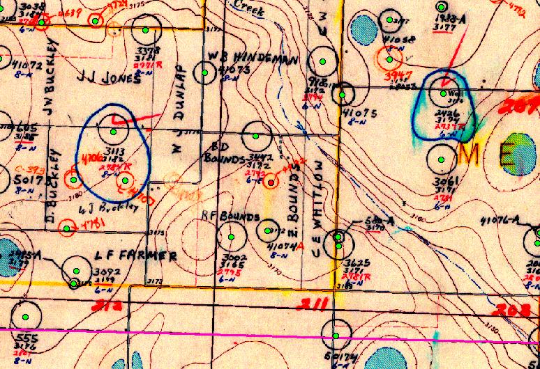 High Plains Water District
The District collects water level measurements for state observation wells annually.Maps of water levels were made by integrating the water level data with a GIS database of existing of District wells. Additionally contour lines showing the water level change were generated as well as maps of two-dimensional interpolated surfaces of water level and changes in water levels over time.
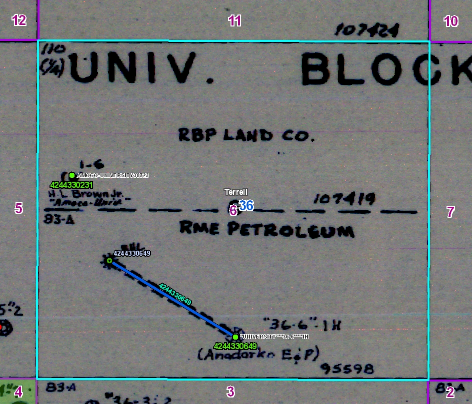 University Lands
The Grazing Leases geodatabase was built by a team of CGST undergraduate students and staff over a period of six months. To capture the grazing lease data layers, 60 NRCS conservation plan maps were scanned and rectified to USGS DOQs. The lease features were then digitized from the scanned images. The principal data layers included the University Lands boundary, grazing lease boundaries, pastures, fence lines, water lines, water point features and cultural point features. To ensure quality map products a topology was built with nine rules among four feature classes. In addition, a feature class of ecological or range sites was developed from SSURGO data to assist University Lands field staff with range planning and management.