
Capabilities
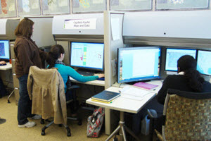
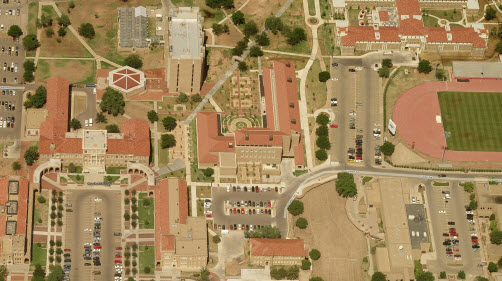 The Center for Geospatial Technology (CGST) occupies several lab and offices in the $37 million Experimental Sciences Facility (ESB). Our area is located in the GIS wing which includes three large lab workrooms with over 2,000 square feet of space and a GIS computer education facility. The GIS computer education facility is immediately adjacent to our lab workrooms and has over 25 new Dell workstations, ceiling mounted projector and two motorized projector screens. There is also a tiered seminar room for 49 students with multi-media, individual Internet connections and power for student laptops, and distance education capabilities. Office space houses the Director, Associate Director and Business Administrative Assistant for the CGST. In addition to the GIS computer education facility in the ESB, we have access to a 16 seat computer lab with instructor workstation and lab server in Holden Hall, a 5 minute walk from the CGST.
The CGST was formally created and approved in 2006; however we have had the opportunity to work on many projects GIS since 2002. The center web site is available to read about some of our projects at www.gis.ttu.edu.
Our history includes winning awards for our maps three years in a row at the ESRI User Conference; one first place (most unique) and two second place (best analytical and best in-house atlas series). We have also had nine of our maps selected for publication in the ESRI Map Book, a distinction unequaled by any other university in the United States. These are big accomplishments for us considering that our beginnings were more than humble. We started in with a closet full of ancient photographic equipment next to a classic cartography lab with drafting tables.
Our hardware resources include over dozen servers, two powerhouse VM ware nodes and 10 virtual server licenses. Our servers are housed in the Technology Operations Server Management facility with temperature controls and 30-day full backups. Our disc storage includes 250 TB of database and flat file storage. Our storage systems are infinitely expandable. We also access our GIS geodatabases via ArcGIS Server including our SQL2008 server.
The CGST has delivered products for many sponsors. Our first project was initiated in the summer of 2002 for the High Plains Underground Water District (HPWD). The HPWD is the first and largest underground water district in Texas. This effort involved converting well data from 328 USGS quad maps into a geodatabase. We delivered a geodatabase of over 72,000 irrigation wells for a 10,000 square mile area with an accompanying web-based Permit Management Application to maintain well data. This program is used daily by the Water District. Other projects completed for the HPWD included a water level and water level change analysis for the Ogallala Aquifer, and technical support and technology transfer.
Other water resources projects we are engaged in are for the Ogallala Aquifer Program of the USDA Agricultural Research Service. We completed development a geodatabase of underground water resources for the Southern Ogallala Aquifer in Oklahoma, Texas and New Mexico for a 19 year period from 1990 to 2008. This geodatabase includes base of aquifer, water level data, and saturated thickness layers. Custom scripts have been developed to process this data to derive water in storage, saturated thickness and changes by county on an annual basis. We have also developed an Ogallala Aquifer Maps website with over 500 maps and graphs depicting the state of the aquifer.
The CGST is a member of the Columbia Regional Geospatial Service Center System (CRGSCS), a consortium of universities and state agencies including S.F. Austin in Nacogdoches, University of Texas at El Paso, Lamar University in Houston, and the Texas Natural Resources Information System (TNRIS) GIS agency in Austin. Our efforts are funded through the U.S. Army National Guard and we work closely with the Texas State Guard on GIS and GPS training for homeland security. One of our key missions is to replicate the states geodata resources to provide backup data, maps and applications in case of a natural disaster or other emergency.
We completed a project for the Canadian River Water Management Authority (CRMWA) to develop a geodatabase containing well and water level data to create hydrologic conductivity and transmissivity layers. This project supported CRMWA in their mission to deliver water to their large service area and eleven municipalities and cities in West Texas.
 We had a team of four undergraduate students work with the U.S. Fish and Wildlife Service to develop the National Wetlands Inventory (NWI) database for the playa lakes region covering 48 counties in Texas, Oklahoma and New Mexico. This project involved re-delineating over 22,000 playa lakes from the originally digitized soils data and then performing photo interpretation of the playa environment. All work is being conducted in a geodatabase environment with full topology rules and validation. Custom NWI topology verification tools are run on each database as a QA/QC procedure. To communicate questions and status between students, staff and sponsors, we developed a web forum which allows messages and photo attachments to be exchanged and stored as threads in a database which can be accessed by all participants. This communication procedure was presented at the annual meeting of the US Fish and Wildlife Service. To date all of the counties we have completed have been accepted by the NWI. This effort represented the second highest priority project of the USFWS for which the CGST completed the largest area of wetlands in the shortest period of time ever accomplished. As a result of this effort, the NWI requested the CGST to perform additional wetlands classification work in 2009 and 2010.
We are also involved in a project to develop the information technology infrastructure and GIS for the Texas Alliance for Water Conservation (TAWC) The TAWC project is a 6 year multi-million demonstration project funded by Texas Senate Bill 1053 to work with 26 producers and their crop and livestock systems to monitor the input and output conditions and total water usage for these system and the economic returns for the amount of water invested (http://www.depts.ttu.edu/tawc/).
We delivered an enterprise geodatabase (ArcSDE) to the University of Texas System, University Lands West Texas Operations in Midland, Texas (University Lands). The significance of the University Lands projects is that they are funded with UT Permanent University Funds from the division that generates the funds from the oil and gas-rich lands of West Texas. University Lands manage over 2.1 million acres in West Texas for grazing leases, mineral leases and pipeline easements. These lands fund the University of Texas and Texas A&M Systems University Permanent University Fund. The CGST is very proud to have been selected for this effort. The development of the geodatabase involved scanning and rectifying NRCS imagery and converted grazing lease data from these images and quad maps. The enterprise geodatabase was produced using ArcSDE and MSSQL server. The application development completed by the CGST allows University Lands to modify the geometry of their leases and maintain a history of the lease geometry and attribute updates in the geodatabase and SQL using a set of custom developed tools in ArcGIS. Included in the deliverables was documentation which included a “Data Dictionary and Standard Operating Procedures Production Processes” document, and a training class to University Lands personnel in the editing of data in the geodatabase.
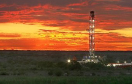
The CGST also developed an oil well and geologic lease management system using SDE also for University Lands. This project involves integrating third party software with their ArcSDE/ArcGIS system to convert textual legal descriptions into polygons in the correct geographic location. This phase of the project has been completed. The locations of over 34,000 oil and gas wells have been created and updated to NAD83 coordinates. In a separate project over 15,000 oil wells were classified using Railroad Commission information and organized in a geodatabase. We also developed a custom ArcGIS application which automatically updates and adds new well locations to the geodatabase after the GPS coordinates and other attributes have been entered into the SQL Server database.
We have since delivered a geodatabase of over 4,000 pipeline easements to University Lands that were developed using Survey Analyst functionality. Also a water atlas for the three aquifers in their region was developed.
We completed a database of caliche (unpaved) roads for 15 counties in West Texas for University Lands. The compilation of this roads database involved setting up an ArcSDE geodatabase so four students could simultaneously capture data and work in the same enterprise environment. This roads database was delivered to University Lands to enhance their ability to access oil wells and assets on their lands.
The CGST also completed scanning and rectifying hundreds of geologic maps for University Lands as well as mosaicing and clipping DOQs and other imagery to support an ArcPad GPS application which we developed for University Lands field crews.
Many students in the CGST have been involved in projects for the Texas Department of Transportation (TxDOT). These projects include ‘A Study of Strategic Military Deployment Routes in the State of Texas’ and ‘Further Refinement of Statewide
Regression Equations for Improved Flood Peak Estimation’. These projects are diverse in nature and require use of functions from dynamic segmentation for linear GIS processing to working with watershed delineation techniques.
We have also been engaged in projects for the F. Marie Hall Institute of Rural and Community Health (IRCH) which resides in the medical school of Texas Tech University. We have completed an on-line Atlas of Rural and Community Health (http://www.gis.ttu.edu/center/cgstARCH) and many maps and projects in support of rural health initiatives in West Texas. We completed a project for the IRCH called “Portraits of West Texas” where are characterizing various layers of data which best portray life, economy, environment and health care in rural West Texas.
Some of our in-house (and award-winning projects) include: The Digital Atlas of Texas Counties (http://gis.ttu.edu/center/DataCatalog/CntyDownload.php/), The Digital Atlas of New Mexico Counties (http://gis.ttu.edu/nmcountyatlas/), Atlas of Rural and Community Health (http://gis.ttu.edu/arch/), and a Unified Model of Phylogeography which involved mapping DNA for bat species in South America. Our tornado map and information is highlighted on the FEMA web site for Safe Rooms and Community Shelters.
Our Ogallala Aquifer Maps can be found at http://gis.ttu.edu/ogallalaaquifermaps. Our main center website is http://gis.ttu.edu/center.
The CGST staff and directors provide project management, database and application design. Our center director is, Kevin R. Mulligan, Associate Professor of Geography. Our students and staff have the capability of developing and designing web pages (ASP.NET, VB.NET), as well as perform ArcObjects programming, SQL database and query development, and routine ArcGIS automation procedures. Our automation capabilities include operating in an enterprise ArcSDE environment with full versioning as well as topology validation. We have an infinitely expandable hardware environment with 250 TB of available fiber channel database and file-based data storage. We operate in a full production enterprise development environment.
In 2005 our Associate Director, Lucia Barbato, was selected as a GISCorps volunteer and spend two weeks in Mississippi assisting the local community, FEMA and the Army Corps of Engineers with damage assessment mapping after Hurricane Katrina. She is an ESRI Certified Instructor for ArcGIS 10 and has taught many classes through out the West Texas community. She is the principle ArcGIS instructor for TNRIS, the state GIS agency for Texas. As the former manager of the ESRI Authorized Training Program, Lucia brings over 9 years of ESRI experience and over 20 years GIS experience to the CGST.
As a Big XII University we are fortunate to have outstanding student resources to fuel our projects. Our projects also provide our students opportunities that they otherwise wouldn’t have during their formal education. The GIS projects we have done are a win-win situation with our sponsors, students and university. We are fortunate to have sponsors who will be glad to give you references and could tell you about our work.
I hope that gives you an idea of our capabilities. Please let me know if you have any questions. If you are in the area, please come by. We'd be glad to give you a tour.

Lucia S. Barbato
Associate Director