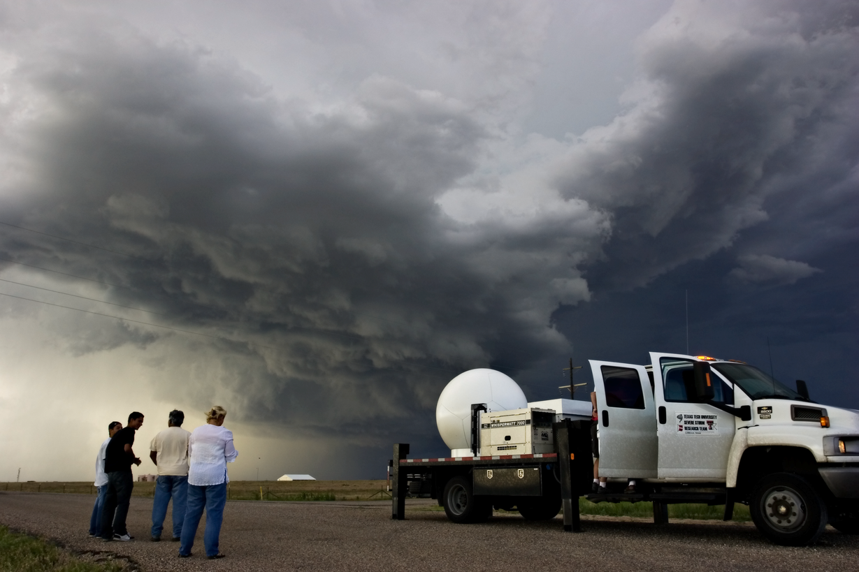
Ka-band Mobile Doppler Radar Trucks

One of NWI's two Ka-band radar trucks in the field collecting data.
NWI has two mobile Ka-band Mobile Doppler Radars. These fully coherent, pulse compression Doppler radar systems utilize traveling wave tube technology and provide the ability for four-dimensional mapping of a wide spectrum of atmospheric phenomena with very-fine spatial resolution useful for both the atmospheric science and engineering communities.
These data platforms allow our researchers to bring the radar instrumentation to the storm (instead of having to wait for the storm to arrive on their doorstep). They also enable four-dimensional mapping of atmospheric events which is useful for both atmospheric science and for wind engineering fields.
The radars are designed to enhance the sensitivity and the resolution of the data collected and allows more in-depth study of fine-scale atmospheric motions. They also have a higher resolution than that usually provided by other types of equipment which helps researchers "see" through the heaviest rains without losing much signal which means clearer (and more useful) data in the end.
The white dome on the bed of each truck houses the radar and protects it from inclement weather - called a Ra-DOME and looks very similar to a large soccer ball.
Studying severe weather and tornadoes can be tricky as these weather events are often "small" enough to just fit between permanent weather observation stations which means that they can "slip through the net" data-wise. StickNets and Ka-band radar trucks are able to "zoom" in to the most important parts of the storm whilst staying a safe distance away from the dangerous weather.
By filling in the data "gaps", both the Ka-band radar trucks and the StickNet platforms provide a much more in-depth picture of the storm/weather event evolution over a period of time. This can lead to more accurate storm forecasts which may mean reduced wind damage and lower loss of life.
(Photo credit: Patrick Skinner, NWI Ph.D. student.)
Radar Rates
Internal projects
(i.e. funded research projects through TTU)
Rollout Fee: $2000/radar/project
Transmitter Fee: $250/radar/hour
External Projects
(i.e. service center activity)
Rollout Fee: $3000/radar/project
Transmitter Fee: $375/radar/hour
TTU Ka-band Radar Specifications:
| Transmit Frequency | 34.86 / 35.06 GHz (for TTUKa-1 / TTUKa-2) |
| Transmit Power | 200 watts peak, 100 watts average |
| Transmitter Type: | TWTA, 50% duty cycle |
| Antenna Type | Cassegrain feed, epoxy dielectric |
| Antenna Gain | 56 dB |
| Antenna 3dB BW | 0.33 degrees |
| Polarization | Linear, horizontal |
| Waveguide | WR-28, pressurized |
| PRF | Variable, up to 20KHz |
| Pulse Width | 4 widths, variable from 30 nsec to 80 usec |
| Gate Spacing | 12 meters |
| Receiver | Dual block up/down converter |
| IF Frequency | 60 MHz |
| Pedestal System | Orbit AL-4016, 6 rpm max axis rotation |
| DSP | Sigmet RVP-900 with Tx IF modulator drive |
| Modulation | Pulse, Linear FM Chirp, Non-linear FM Chirp |
| Vehicle | Chevy C5500 crew cab, custom bed |
| Plaform Stabilization | Computer assisted hydraulic leveling system |
National Wind Institute
-
Address
1009 Canton Ave., MS 3155 Lubbock, TX 79409-3155 -
Phone
National Wind Institute - 806.742.3476; Renewable Energy - 806.742.6284 -
Email
National Wind Institute - nwi@ttu.edu; Renewable Energy - windenergy@ttu.edu
